March 26, 2023

Bermuda, Crystal Cave

 Bermuda is a British Overseas Territory in the North Atlantic Ocean. The Bermuda archipelago consists of 181 islands. Many of the islands are limestone.

I joined a tour to Crystal Cave on Bermuda. The cave is in the parish of Hamilton. Went in a van from the Royal Naval Dockyard and saw virtually all of the north side of the island during the 70 minute ride. Crystal Cave is at the eastern end of Bermuda, in an area where several other caves are marked on my map. 


Had to wait for our tour. In through the gate then down a slope through a man-made tunnel. 


Where the natural cave starts are stairs going down to the floor of the chamber. This has lots of stal.


This whole chamber has a lake, which is crossed on floating pontoons. The lake is crystal clear, hence the cave name, and is up to 55 feet deep. It is salt water and there are 2 flooded passages leading to the sea. The ceiling is covered with stalactites, really beautiful, although many are broken at the end. There is at least 1 stalagmite in the lake. 


Very beautiful cave and everyone was very impressed. Fairly short cave, and you go out the same way. 

Outside on the hill opposite the cafe is a small building which is where the original entrance is located - this is close to the sinkhole which was the original entry used by the 2 boys who found the cave when looking for their cricket ball. We didn't have time to see it after (it is a pity the van driver hadn't told us when we arrived, when we had 35 minutes to spare).


The cave was discovered on 3 March 1907. Two boys lost a cricket ball in a hole in the ground, and clambered down to look for it. Later one boy was lowered into the rope by his father, using a strong rope tied to a tree. The child descended 140' using a bicycle lamp. They never found the ball, just the cave. This entrance was called Discovery Hole. The cave was surveyed and it was found that an entrance suitable for visitors could be made a short distance away. A wooden staircase was built enabling visitors to go down to the lake. 

The cave first opened as a show cave on 8 Jan 1908. The cave became to popular that it was necessary to find an easier way to gain access. In 1912 work began on the present day tunnel. After opening in 1914 the original entrance was disused and the staircase removed. 

Fantasy Cave is also well decorated with stal and has pools at the bottom. 

The islands of Bermuda sit on a long extinct volcanic seamount in the part of the North Atlantic known as the Sargasso Sea. The islands were created by mid-ocean volcanic eruptions about 35 million years ago. Today the above water island rocks  are almost exclusively limestone, with the seamount below. So Bermuda has igneous and sedimentary rocks.

See The Crystal Caves website. And Crystal Caves on Wikipedia.

September 13, 2022

Reigate Caves, Surrey - old sand mines

The town of Reigate in Surrey sits over a network of caves. The caves are actually old sand mines. The area is formed in soft sandstone and this has been mined over several centuries. It was used to make glass. There are 2 main set of caves, East and West Caverns in Tunnel Road and Barons’ Cave in the castle grounds. The castle mound overlooks Reigate town, though nothing remains of the castle.

Access to the mines is controlled by the Wealden Cave and Mine Society and they hold open days. Firstly I went to the Tunnel Road caves. Tunnel Road was built in 1823 and is now the oldest road tunnel in Britain and one of the oldest in Europe. It runs through the hill from the town towards the railway station. Looking from north to south -


Tunnel Road West caves were sand mines. The rock dates to the Cretaceous period, 145 to 66 million years ago. It is called silver sand and is quite pure and makes good quality glass. It is easily dug, using picks, yet the remaining pillars are strong enough to provide support. There is electric lighting.


It is thought mining stopped in the 1860s, probably because of a collapse of the ground above which caused a cave in. During the First World War, the tunnels were used to store explosives. During the Second World War they were used as public air raid shelters, people slept here over several months.
And now the caves are used by a shooting club. Because the sand is so soft and easily penetrated by bullets, wooden sleepers are used to protect some of the walls -

In the 1980s health and safety meant additional brick walls were put in places deemed necessary, as well as an emergency exit. Carvings of unknown date -

Remains of old bottles - ironic that the caves were mined to produce sand to make glass and then old bottles have been left in the cave.

Pick marks -

After the tour I went across the road to Tunnel Road East Cave, which is a self guided tour. These caves were dug specifically for storing wines and beers, from the middle of the 19th century. They were also partly used as a shelter and emergency services control centre during WW2. The cave now has lots of memorabilia about the history of the area.


In Tunnel Road -

After lunch I went up to The Baron's Cave. Very little is known about the history of the cave, it is not certain why it was dug or how it got its name. It is situated below the castle grounds. A few steps lead down into the cave, and it has been used as a show cave possibly since the 1770s or earlier. 

The cave is basically 2 passages. There used to be an upper entrance but this is not safe for visitors due to a collapse. There are lots of carvings of names etc on the walls. For detailed information and a survey, see The Baron's Cave.

And for more on Tunnel Road Caves.


August 20, 2022

Gutman's Cave, Gauja National Park, Latvia

 I was in Riga, Latvia, in August 2022 and did a tour to the Gauja National Park. This covers a large area northeast of the capital, Riga. The town of Sigulda is within the park and is 50 km from Riga. There were several caves shown on my map and I was able to visit one of them.

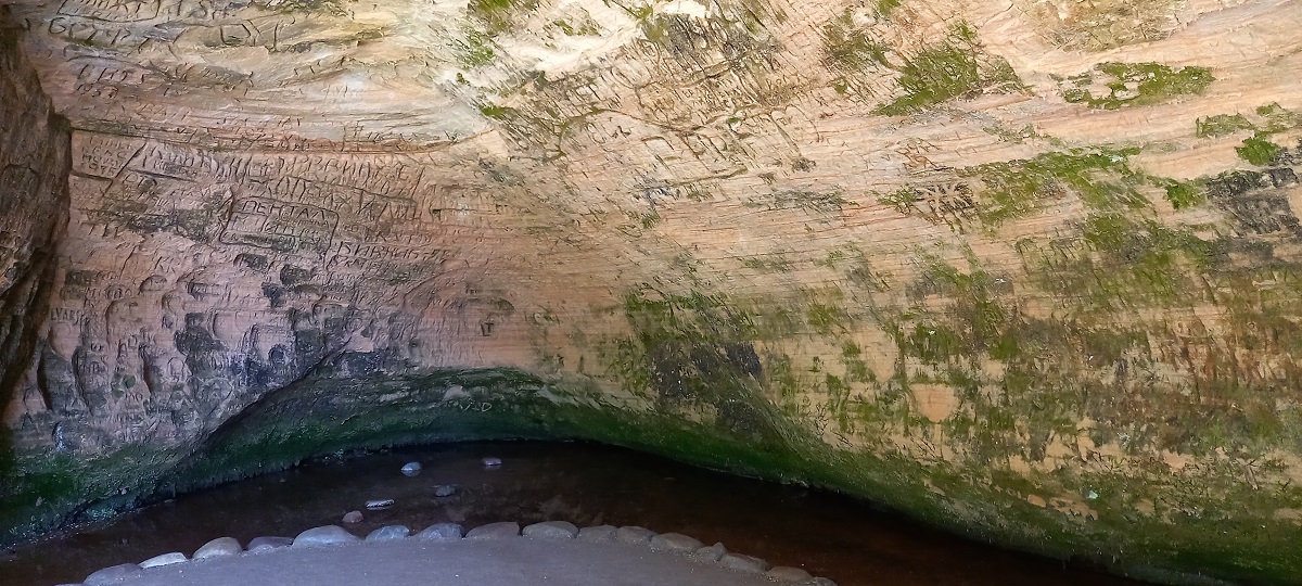
Gutmanis Cave, Gutman's Cave, Gutmana Ala, is the widest and highest cave in the Baltic, located on the Gauja River in the Gauja National Park, Latvia. It is 19 m deep, 12 m wide and 10 m high and formed of sandstone. There is a spring in the cave.


The name good man is from a legend that in ancient times the cave was home to a good man who used the water of the spring to heal people.

On the walls are inscriptions from 17th c. This makes it one of the oldest tourist attractions in Latvia.

The legend of the Rose of Turaida began in the cave. 


The Gauja National Park is the first national park in Latvia and protects the ancient valleys of the Gauja River and its tributaries. There are many slopes, valleys, springs, and  sandstone cliffs and caves located closely together. The red sandstone rocks date back 370 - 387 million years from the Devonian period.

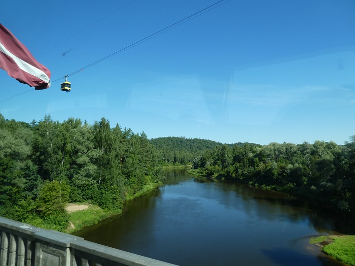
View of the Gauja valley from Turaida castle and from the road bridge with a cable car and the Latvian flag.


As already mentioned, the rocks date back to the Devonian period, roughly 387 million years ago. The cultural centre in Sigulda is called Siguldas devons and is named after the geological period of the sandstone rocks.

See more on Gutmanis Cave on Wikipedia. And other caves in the area.

June 5, 2022

Underground London - a walk in Kingsway tram subway

 I have already blogged about The Kingsway tram subway in London, having only seen the entrance from the surface. To do a tour inside had been on my "to do list" for a while, and in March 2022 I was able to make a booking for a tour over the Queen's Platinum Jubilee weekend in early June 2022. Tours are organised by London Transport Museum Hidden London and will run in June and July.

This is the tram entrance to Holborn station. The poster shows the original shape, an arched entrance, which was later enlarged and squared in 1929 to accommodate the double-decker trams.


The major road of Kingsway opened in 1905, named after King Edward VII. The surrounding area was surrounded by a maze of small streets and slum dwellings, with high crime rates and establishments of ill repute. It was intended to be a new business district for London and was built as a wide boulevard with grand office buildings. Transport was then needed to bring in the workers.

The tramway opened in 1906 having been built by the London County Council. It was part of a renewal programme for the Holborn and Aldwych areas. It joined the North and South London tram systems.

These are the only surviving tram rails in London (excluding the modern present day system around the Croydon area). 


These are the pedestrian entrances to the station, looking south and then north -


The walls in places are lined with glazed bricks


This is a double height escape niche

The ceiling supports -


The last tram ran in July 1952 as trolleybuses had become more popular. The southern end was converted into a road tunnel. Since then the tunnel has been used for filming. Union Street is a fictional station in the film The Escapist.

The only other use is for storage by the council. Looking back to the tram entrance -

During the construction of Crossrail, a shaft was dug in the floor to allow access to make the new tunnels. After completion the area was restored so it visually looks in its original state.

This light above the entrance is an original, whereas the two at the start of the ramp are replicas -


See more on Wikipedia and IanVisits.

February 13, 2022

Underground London - Carshalton Park grotto

 The grotto is a small manmade structure in Carshalton Park, in the London borough of Sutton. According to Wikipedia, the grotto was built in 1724. It is located in the southeast corner of the park. A now dry canal extends north from the grotto and can clearly be seen on this Google image -


The canal extends along Carshalton Place, visible on this Maps.Me image -


I walked in from Carshalton High Street and this is the vertical green strip, north of Talbot Rd -


An looking back -

This is the canal section between Talbot Rd and Ruskin Rd, looking south -


There is some water at the southern end, by Ruskin Rd -

This is the main area, looking towards the grotto -


And the grotto -

Access into the grotto is blocked by locked gates. I couldn't see much looking in through the centre gate, apparently the roof was covered with shells when built. 

Looking back down the canal from the top of the grotto, not sure what the concrete cap is in the second photo -


It must have looked quite attractive in the days when water was flowing out of the grotto -


There is a good history of the park and grotto on yourlocalguardian . And a short feature on Wandle Valley . According to Historic England, the grotto is a listed building.